Where the van goes
Locksmith Monte Pego, and the villages of the plain towards Dénia
Every part of Monte Pego, whichever of its three town halls your house belongs to; every corner of Pego’s 52 square kilometres; and the villages of the plain between Pego and Dénia. Same services everywhere, same phone number.
Open 24 hours · 7 days
- Monte Pego: all three parts
- Eight villages of the plain
- No valleys, no Oliva
Monte Pego
One urbanisation, three town halls
One urbanisation on the registers of three municipalities: 484 people on Pego’s side, 66 on Dénia’s and 122 on El Ràfol’s at the start of 2025. On Pego’s side nearly nine in ten are foreign nationals and more than half are 65 or over. All three parts are covered, whichever town hall your house belongs to.
| Registered in Pego | 484 residents |
|---|---|
| Registered in Dénia | 66 residents |
| Registered in El Ràfol d’Almúnia | 122 residents |
| Pego’s side in 2010 | 1,076 residents |
Figures from the municipal registers, as published by the INE.
What it means for a call-out: give the name of the house or the street, and send a map pin on WhatsApp if you can. If you live alone up there, or look after someone who does, read whether a key box by the door is a good idea. Bought a house there recently? Changing every lock when you move in has a page of its own.
The municipality of Pego
From the old walls to the marjal and the sierras
-
Inside the old walls
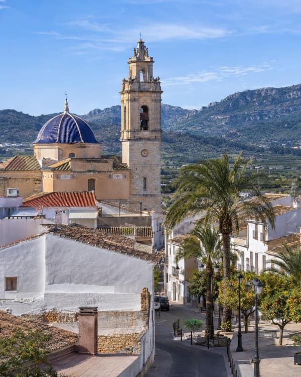
The medieval core round the Plaça de l’Ajuntament
The Christian town laid out after the charters of 1279 and walled from 1291, with sixteen towers and three gates. Only the Portal de Sala still stands; it opened onto the huerta and was shut every night. Pieces of the wall survive inside houses on Sant Jaume, Capità Cendra, Mestre Blasco and Sant Lluís, and the streets are as narrow as you would expect.
Also called or including: Portal de Sala, Carrer de Sant Domènec, Sant Jaume, Capità Cendra, Mestre Blasco, Sant Lluís, Vallet, Església de l’Assumpció
-
The town outside the walls
Round the old core, out to the roads for Oliva, Dénia and El Verger
Pego grew out past the line of the wall towards the huerta. The industrial estate sits beside the town on the way in from El Verger; the council already had cameras on it in 2023 and set out that year to add more.
Also called or including: the newer streets and blocks, the Calvari, Polígon Industrial de Pego
-
The partidas among the orange groves
The raiguer, between 5 and 80 metres up, all round the town
Citrus covers 1,664 hectares, the largest crop in the municipality, and it is watered from wells. The toponymy lists pump houses by owner, the Motor de Sant Josep, de Server, de la Viuda, as well as farmhouses and a riurau. Several partida names are older than the town itself.
Also called or including: Benigànim, Atzaïla, Favares, Benumeia, Benisuleima, Rupais, les Verdales, el Murtar, Sant Antoni, Salamona, Cotes
-
The marjal
East and north-east, shared with Oliva and Dénia
A coastal marsh fed by the Bullent and the Racons and by springs from the Mostalla and Segària aquifers, a natural park since 1994 and a Ramsar wetland. Rice is still grown here, bomba and the local bombó. What there is to lock is mostly huts, stores and gates, and everything stays damp.
Also called or including: Parc Natural de la Marjal de Pego-Oliva, les Marjals Majors, les Tanques, Riu del Bullent, Riu dels Racons
-
Under the sierras
West and south: Segària, the Serra del Cavall, Mostalla
The mountain third of the municipality, up to 359 metres on Mostalla. The Arab castle of Ambra sits on its own hill, and the walks up to it start from tracks below, where a car is left for the morning.
Also called or including: Castell d’Ambra, Serra de Mostalla, Serra de Segària, Bodoix, Penyalba
The plain towards Dénia
Eight villages beyond the town
The van goes as far as these, in any direction the work needs. Orba, Beniarbeig, Sagra, Tormos and El Ràfol d’Almúnia are covered just like Pego, and so are El Verger, Els Poblets and Ondara.
- El VergerOn the road from Pego towards the coast, past the industrial estate.
- Els PobletsPego’s official place names include the road that leads there: the Carretera dels Poblets.
- OndaraFurther along the plain, towards Dénia.
- BeniarbeigOn the same plain, on the way towards Dénia.
- OrbaSouth of Pego’s sierras. In the storm of 24 July 2025, AEMET’s gauge here caught 79 l/m², against 90.2 in Pego.
- Sagra and TormosTwo villages that border Pego to the south; the Carretera de Sagra leaves from Pego itself.
- El Ràfol d’AlmúniaBorders Pego, and holds part of Monte Pego on its register.
Not covered
The inland valleys (l’Atzúbia with Forna, the Vall de Gallinera, the Vall d’Ebo and the Vall d’Alcalà) and Oliva, over the provincial border. Rather than a long wait, you will be told so on the phone.
Everything that gets done, everywhere above
The full list of services
- Shut out, any hour I am outside and the door will not let me in
- Opening without damage Get it open, and leave the door in one piece
- Worn and stiff locks The lock grinds, sticks or is simply worn out
- Moving in: every lock I have just bought or moved in and do not know who has keys
- Shops, bars and offices The premises will not open, or the locks must change
- After a break-in Someone has forced the door, or tried to
- Keys locked in the car The car is locked and the keys are inside it
- Safes opened and fitted The safe will not open, or a new one needs fixing
Not sure whether your address is inside the area? Ask: the contact page lists every way to do it.
What people need next
Most asked for across the area
Somewhere on this page and locked out?
Ring, say the village or the name of the house, and send a pin on WhatsApp. You will hear honestly how long the drive is.
Open 24 hours · 7 days